Feasibility study in one click
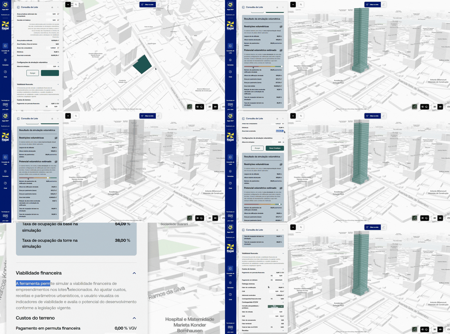
Pick any lot and see every rule and exception that applies to it, a 3D volume of what fits inside the law, and a preliminary financial feasibility.

The urban digital twin your city runs, and opens to developers, investors and citizens.

The platform is run by the city government and opened to the people who build in the city and live in it.
Pick any lot and see every rule and exception that applies to it, a 3D volume of what fits inside the law, and a preliminary financial feasibility.

An AI chat trained on the city’s own legislation. It answers from the municipal code and cites the article it came from.

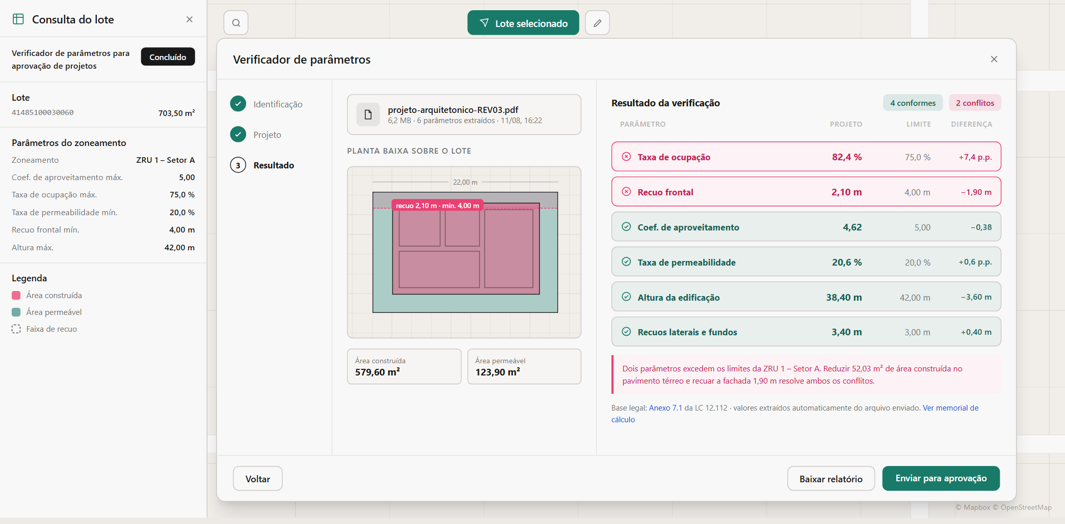
Before a project is filed, the architect uploads the project files in PDF. The system reads them and checks the project against the city’s legislation, already parametrized in the platform. It returns a report of what complies and what doesn’t, so the architect fixes the issues before formal submission.
When the project is filed with the city, it has already been checked, so the technical team spends its time on projects that comply instead of returning them for corrections.

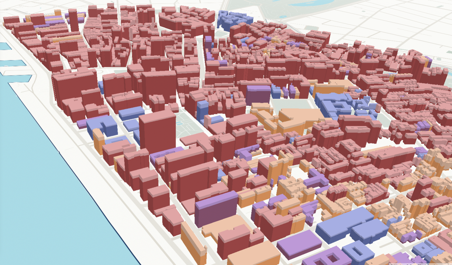
We run the current legislation against the proposed one, lot by lot, across the whole territory. The city sees where it densifies, where it empties and what it does to the environment, before the public hearing.

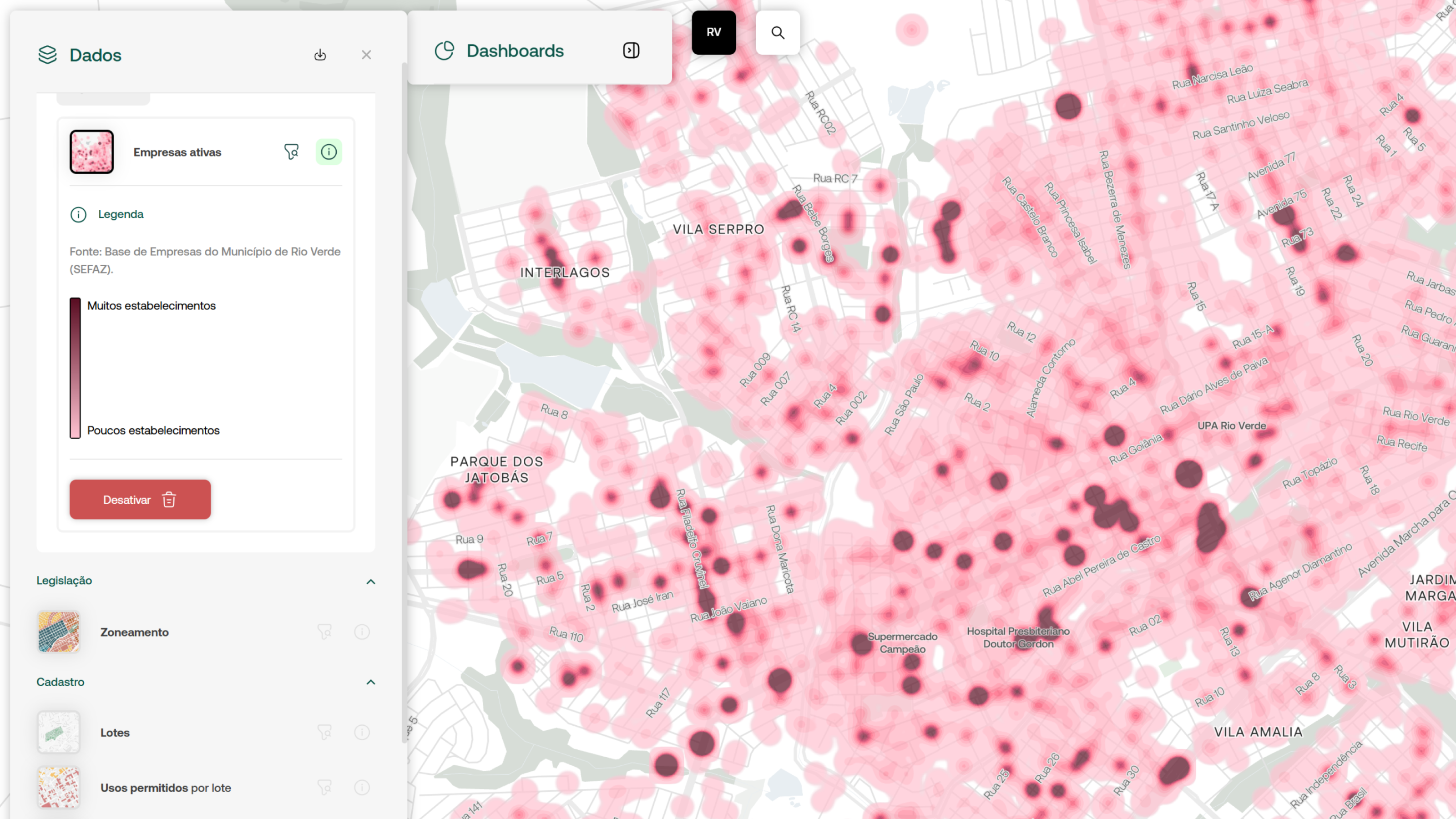
Territorial intelligence comes from integrating multiple data sources, from the municipality and the market, into a single, reliable view of the city. By combining zoning rules, cadastral data, real estate transactions, pricing and market activity, we enable better-informed decisions.
In Porto Alegre, it showed where accidents concentrate and which corridors were safest. In Itajaí, it revealed lots taxed below what they should be.

Citizens see what is happening in their city: which public works are underway, where a street is being renovated, where a new hospital is being built. The same open platform shows investors, businesses and new residents what the city offers and where it is heading, bringing new people to the city.
It gives the community a place to follow and engage with what is being decided.

want to see it running on your city?
book a demo“Before, people who waited up to a month to get information from city hall can now get it in a matter of seconds.”
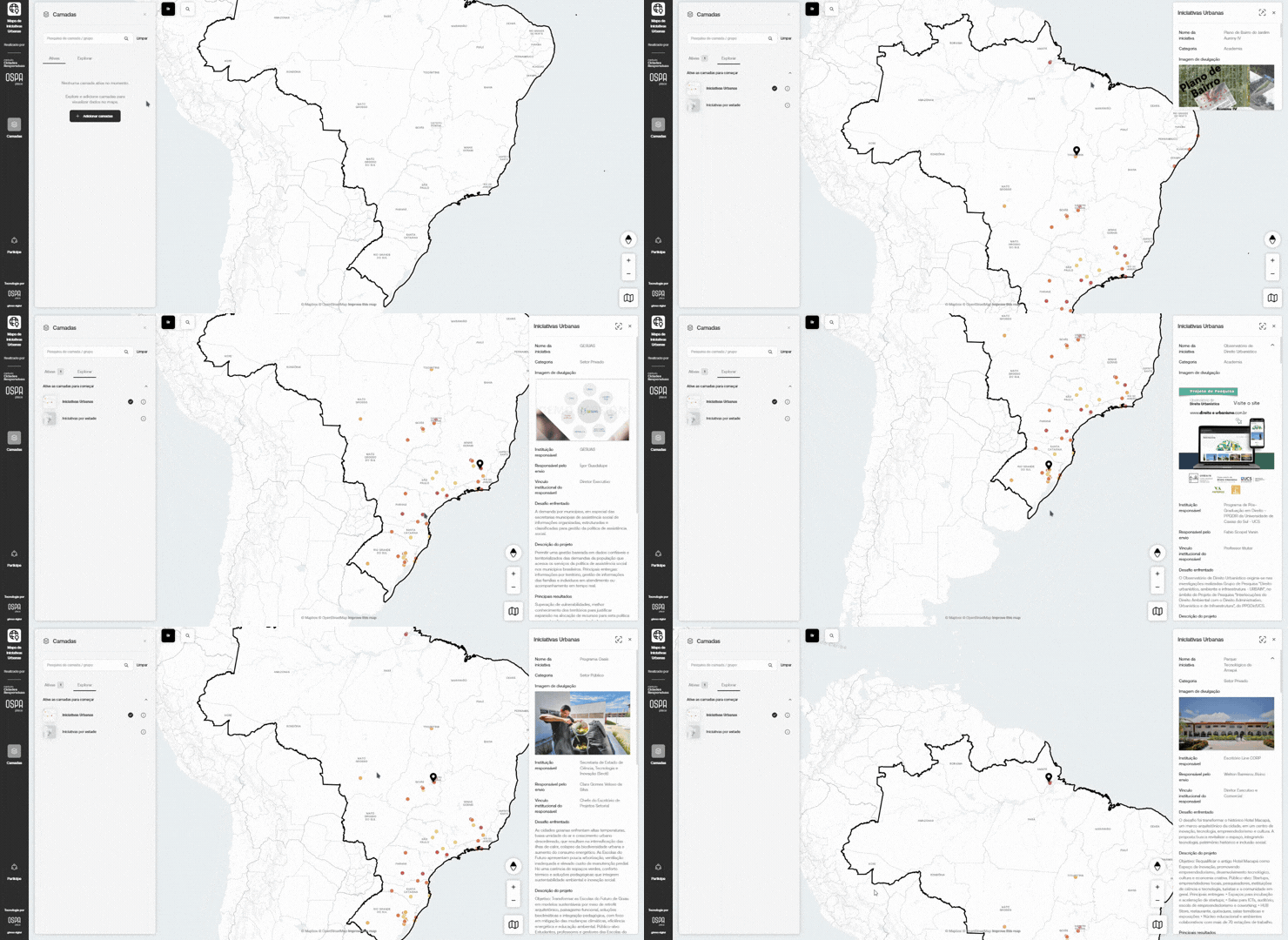
OSPA Place launches interactive map with all projects from ArchDaily Brasil
Can technology fight flooding in cities?
Responsive Cities in the arena: Brazil floods

Flávia Tissot: the platform she built helps companies understand local building rules. Her next challenge is a tool for public managers

Itajaí launches a free platform with planning information for any lot in the city
Maceió’s city government launches an integrated territorial intelligence platform for planning queries
Urban development only reaches its full potential through ongoing dialogue between government, market and academia, backed by data and interoperability.
Facing that complexity, OSPA combines data-driven and design-driven approaches to simplify urban development.
Through the platform, you get access to articles, classes, podcasts and events, and connect with people who think about cities.
join the communityTell us about it, and we’ll show you how OSPA Place can help.